Mapping goes high-def
Walking into the Palace Museum, Beijing's pre-eminent historical site and tourist attraction, a visitor can simply point her smartphone at a palace in the precinct to see the ancient building and its surroundings in 3-D.
The content is vivid and extremely informative. What the palace was used for, how many people are there right now, and how to reach it ...such details are available at fingertips, thanks to the innovative application of a high-definition mapping solution developed by Chinese firm Huawei Technologies Co Ltd.
Dubbed Cyberverse, the hand-held device app uses virtual reality or VR and spatial computing to enable people to navigate and learn about their surroundings.
To make it more creative and engaging, the app may be able to incorporate social functionalities in the future, where people will see passersby with their hobbies showing overhead on their handsets, said Luo Wei, a chief engineer from Huawei.
Though the tech has not been commercialized yet, it epitomizes the ambition of China's largest smartphone maker to develop high-definition mapping capabilities. This move came right after Huawei announced plans to unveil in October its own mapping services called Map Kit.
Luo predicted that Cyberverse, the VR mapping platform, will be used in public places including tourist attractions, museums, smart campuses, airports and high-speed railway stations.
"It will be available at 100 sites by the end of the second quarter of 2020, and at 1,000 sites by the end of next year."
Tech industry insiders said Huawei's entry into the mapping sector marks a broader trend in China. Leading internet firms, tech giants, traditional vehicle manufacturers, they said, are all itching to beef up their presence in the high-definition mapping sector.
"High-definition maps" refers to electronic maps with higher precision and more data dimensions. With an accuracy detailed in centimeters, such maps are able to connect people, objects and surrounding environment to act as "live maps".
On Aug 30, the Shenzhen-based firm also inked a strategic cooperation agreement with the Land Satellite Remote Sensing Application Center affiliated to the Ministry of Natural Resources. The two sides will cooperate to improve remote sensing, a key driver of high-definition mapping services.
"For Huawei, the move is part of its accelerated push to build a more robust mobile app ecosystem to boost its businesses," said Xiang Ligang, director-general of the Information Consumption Alliance, a telecom industry association.
Xiang noted that Huawei unveiled its in-house mobile phone operating system HarmonyOS last month. There is a pressing need for the company to attract more software developers to make apps for the system.
"It is also Huawei's efforts to offset the impact of the US ban on using Google Maps in its overseas smartphones," he said.
His comments are in line with Huawei's efforts to develop the internet of vehicles, or IoV, to bolster its core businesses. Back in 2013, it released self-developed ME909T vehicle module and pledged to invest hundreds of millions of dollars each year in research and development of the IoV.
Later, it signed cooperation agreements with vehicle manufacturers including Mercedes-Benz and Audi to offer its telecommunications module. Huawei has also deployed its Wi-Fi hotpots for Japanese carmaker Toyota.
"With Huawei's telecom base stations in over 160 countries and regions, it can offer more complementing information to satellite positioning data and thus provide better mapping services in the future," Xiang said.
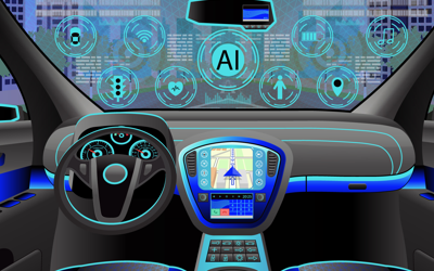
Song Baicheng, a senior analyst from the Gasgoo Research Institute, a vehicle consultancy, said high-definition mapping services are heating up in China as they will play a critical role in achieving autonomous driving.
"For an autonomous vehicle, its most important role is to know and understand its position and surroundings. The high-definition map brings functions like high-precision localization, environment perception, planning and decision-making to autonomous vehicles," he said in an industry report on high-precision maps published by the Gasgoo Research Institute.
Compared to traditional navigation maps that are accurate to the "road level", high-precision maps can achieve information recognition at "lane level". They are able to recognize different obstacles such as non-motor vehicle lanes, road teeth and green belts, the report said.
Major Chinese tech companies such as Baidu Inc, Alibaba Group, and Tencent Holdings Ltd already have a presence in the high-definition mapping sector. Their presence has raised hopes of a potential market of 30 billion yuan ($4.2 billion) over the next few years, said CITIC Securities.
Baidu, one of the earliest movers into autonomous driving, has been in the sector for years now. Its high-definition maps are based on the requirements of Level 3 autonomous driving and are known to have the highest level of refinement, productivity and coverage in the country.
Level 2 means "hands off"-the automated system takes full control of the vehicle, but the driver must monitor the driving and be prepared to intervene immediately at any time. Level 3 refers to "eyes off"-the vehicle will handle situations which require an immediate response, and the driver must still be prepared to intervene within some limited time.
Baidu's archrival AutoNavi, also known as Amap, was acquired by Alibaba in 2014. The firm launched last year an integrated solution for high-precision maps, which enables an accurate mapping with an error range of less than 7 centimeters under normal road conditions, one of the lowest error ranges so far.
Together, Tencent Map, Baidu Map and AutoNavi account for over 80 percent of the domestic mapping sector.
While companies are stepping up efforts in the field, Feng Hanping, chief technology officer of Chinese map provider Kuandeng, said the current phase is "only the beginning".
"For a well-rounded high-definition mapping solution, the very first bar is to have qualifications for surveying and mapping," Feng said.
"That's why, most domestic manufacturers prefer to find one partner that has the qualifications and can provide such maps for mass production," he said.
Some 20 Chinese companies and entities, including Chinese mapping provider NavInfo and the National Geomatics Center of China, have acquired class A qualification of surveying and mapping in the country.
NavInfo said earlier that it expects to finish China's first high-definition map by the end of this year. It also said it leads the domestic standards for making such maps.
The Beijing-based company is also one of the most reliable partners of global carmakers in the Chinese market. In July, BMW China inked a partnership with NavInfo to develop high-precision maps for autonomous driving.
At that time, Gao Le, president and CEO of BMW Group Greater China, said: "High-precision maps have irreplaceable importance in forecasting, driving strategies and safety. This cooperation will greatly promote BMW China's progress in the field of autonomous driving."
With autonomous driving accelerating its steps toward possible commercialization in the coming years, the high-precision mapping industry will be lifted to a new high, experts said. A Goldman Sachs report said the market size of high-definition mapping will grow to over $30 billion by 2030.
Consulting firm McKinsey said China has the potential to become the world's largest market for autonomous vehicles. It estimated that such vehicles will make up more than 40 percent of new vehicle sales in China, the world's largest auto market, by 2040.
"It's widely recognized that by 2025, the Level 3 autonomous cars are expected to account for 12 percent of total and that all the high-end cars will be embedded with Level 3 functions," said Guo Jishun, chief smart driving technology officer at the research department of Guangzhou-based GAC Group.
By that time, Chinese consumers will have a strong willingness to buy autonomous vehicles and have higher demand for such cars, Guo said.
"The higher expectation will drive the high-definition mapping market to grow fast. Related mapping providers should make sure ahead that such maps can offer safe and reliable services to unmanned vehicles."


